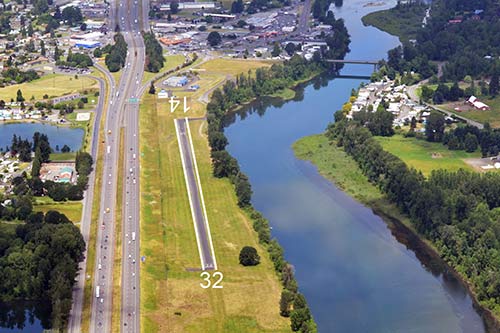
Woodland State Airport runway.
Airport Alert
Please check NOTAM’s and contact the State Airport Coordinator at john.wilson2@wsdot.wa.gov or 360-618-2477 for updated information or questions.
Location
ID
Sponsor
Rules
 Camping
 Picnics
 No fire rings
 No outhouse
 No water
 Facilities
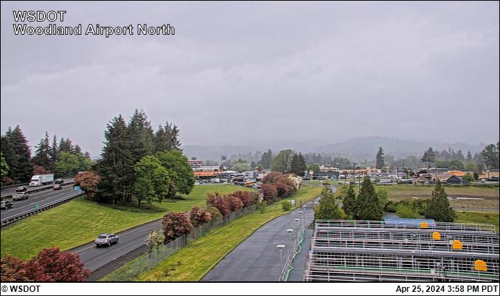
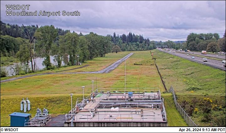
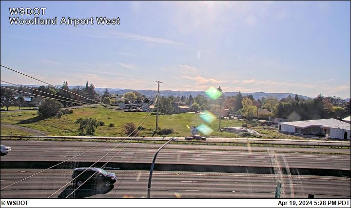
Airport Cameras

Available information for airport
Midway between Kelso and Vancouver is an excellent example of a state airport turning into a community airport. Woodland's value is extremely hard to place, but must be considered high. In the last decade Woodland has gone from a little dirt and grass track, to a lighted, paved 1,953 foot asphalt strip. There are fine restaurants and motels within walking distance, and other city functions. The Lewis River runs along the east edge of the field and steelhead fishing common. Swimming is not recommended due to unexpected water level fluxuations and resulting current from the upstream dam. Interstate 5 runs along the west edge and ground transportation is easy to find.
The airport is open year around, except for times when the river level exceeds the field elevation. There are obstructing trees along the banks of the river to the east, and the Interstate and sign bridge is significantly higher than the airport on the west. The approach from the north contains powerlines, and the city sewer plant. The approach from the south has trees and a bridge. One caution: When there are strong winds from the east, the turbulence can be severe, and landing impossible. Overflight to check field conditions is recommended.
This web camera is owned and operated by WSDOT Aviation.
The camera is mounted on a power pole approximately at the Northwest corner of the treatment plant facility. The camera captures four views that should indicate the direction: North, South, East, and West along with a time/date stamp. The camera operates 24 hours a day with images updating every 15 minutes.
To report a problem with the camera contact: John Wilson, 360-618-2477 or email john.wilson2@wsdot.wa.gov.
All information subject to use disclaimer.