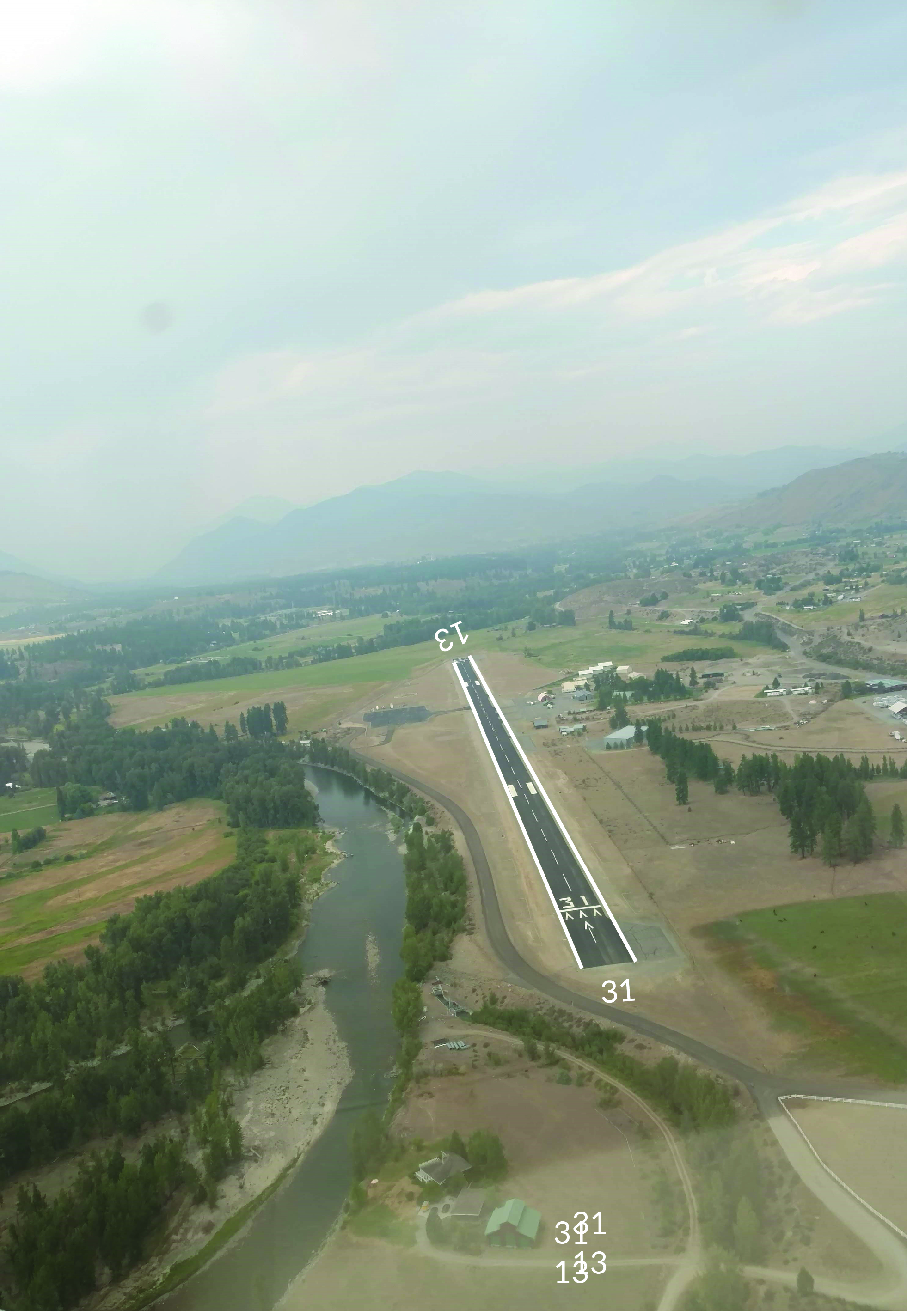
Methow Valley airport runway.
Airport Alert
Exceptions: Airport beacon pilot radio controlled on Rwy lighting circuit and times out at 5 minutes. Rwy lights time out at 15 minutes. Limited snow removal in winter months. All use at own risk.
Please check NOTAMs for possible temporary closures due to winter weather conditions.
Contact the State Airport Coordinator at john.wilson2@wsdot.wa.gov or 360-618-2477 for additional questions.
Location
ID
Sponsor
Weather information
AWOS III-P
(509) 997-0142
Frequency - 118.425
NOAA
Rules
 No camping
 Picnics
 No fire rings
 Outhouse
 No water
 No facilities
Airport Cameras


This web camera is owned and operated by Washington State Department of Transportation (WSDOT) Aviation.
The camera is located on the East side of the airport on the North Cascade Smokejumper Base administration building 's communication tower. The camera provides four views: Northwest, West, South and Southeast.
The images displayed should indicate the direction northwest, west, south, and southeast along with a time/date stamp.
The camera operates 24 hours a day with the images updating every 15 minutes.
To report a problem with the camera contact: John Wilson, john.wilson2@wsdot.wa.gov or 360-618-2477
All information subject to use disclaimer.
Available information for airport
To see the Methow Through the Fence Fee Review, please email christina.crea@wsdot.wa.gov for a copy.
To see the Methow Valley Master Plan, please email christina.crea@wsdot.wa.gov for a copy.
Methow Valley State Airport is located in Okanogan County approximately 5 miles south of Winthrop, WA. The airport has been described as the “Crown Jewel” of the state-managed airport system and is the only state-managed airport included in the FAA’s National Plan of Integrated Airport Systems (NPIAS), making it eligible to receive airport development grants from the FAA Airport Improvement Program (AIP).
The Methow Valley State Airport is a public-use facility owned and operated by WSDOT Aviation. The airport has a single, asphalt surfaced runway (Runway 13-31) measuring 5,049 feet long and 75 feet wide and is equipped with standard medium intensity pilot-controlled runway lighting. Transient Aircraft parking is provided on the West side and ground access is from the Evans Road only.
Restricted Area: Do not access the U.S. Forest Service Smokejumper East side three taxiways or access the airport from the east side Intercity Airport Road. All vehicle access to the airport from the east side must be approved in advance. Access to the Smokejumper base for a public tour is from the Intercity Airport Road only. Fuel is provided by a private through-the-fence operator and can be accessed from the northern most eastside taxiway north of the Smokejumper base.
Warning note: Google Earth and FAA Chart Supplement exhibit maps are outdated. The runway, taxiways, and aircraft parking areas have been extensively revised in 2017, however aerial mapping and charts are slow to be updated.