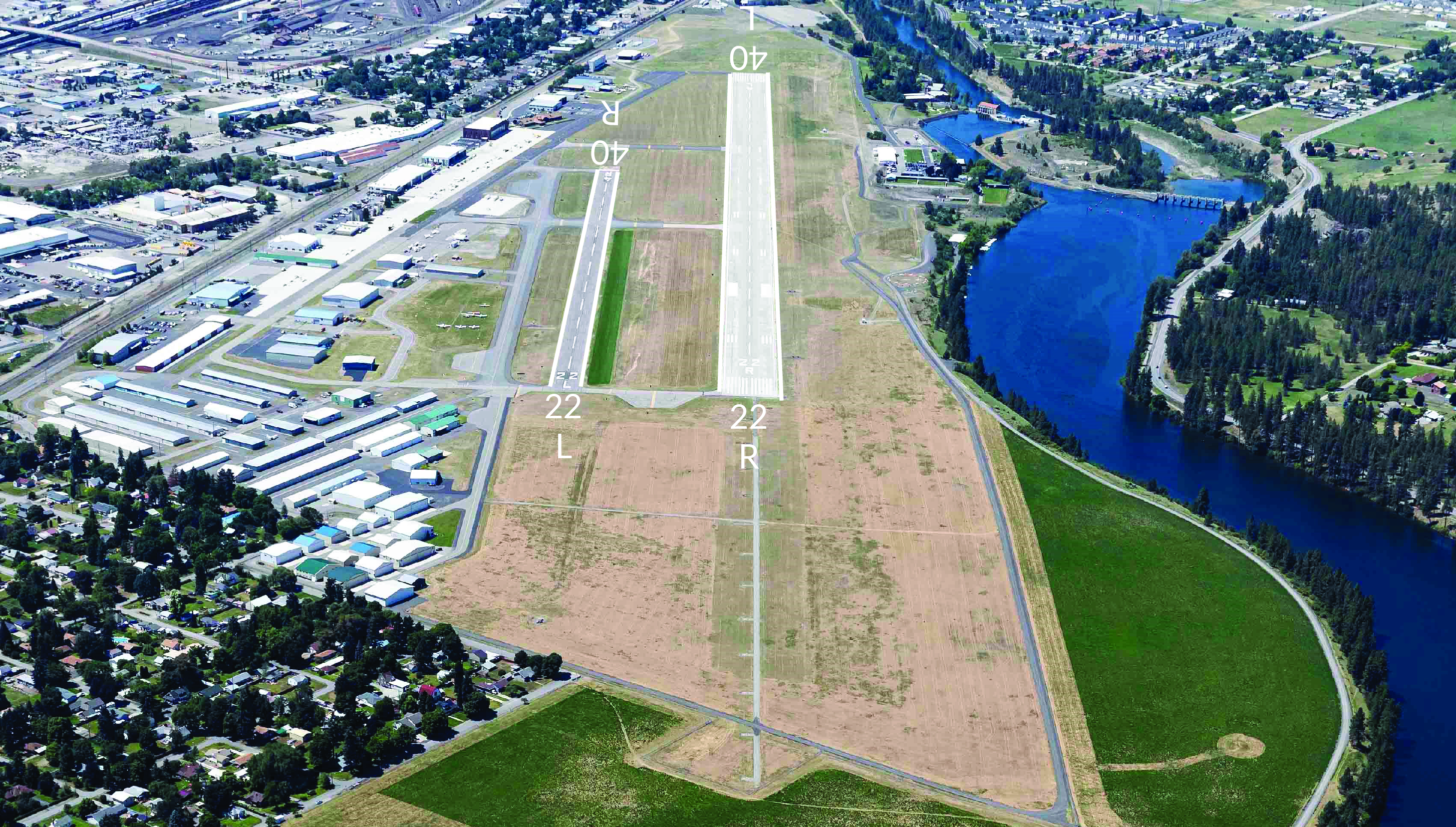
Felts field airport runway.
Location
ID
Sponsor
Airport Website
Weather information
Airport Cameras
Available information for airport
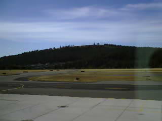
This camera image is provided courtesy of the Spokane Chapter of the Washington Pilots Association.
The image is taken from the second floor of the Felts Field Flight Center building looking to the northwest. Taxiway Alpha crosses from left to right and Taxiway Delta can be seen just to the left of the fuel island. Taxiway Bravo and the parallel Runways 4/22 are beyond the aircraft tie down area. Fancher Beacon Hill in the background is about 650 feet above the field elevation and approximately 1 mile to the northwest.
The camera image updates every five minutes. Since this is not a WSDOT web cam, please use the refresh button on your browser to view the updated image.
To report a problem with the camera contact: Al Gilson at alcessnapilot@comcast.net.
All information subject to use disclaimer. The web cam images are being provided as a service for pilots to view current airport conditions. They should not take the place of a pilot’s responsibility for obtaining a regulatory compliant weather briefing prior to flight from automated resources or from Flight Service.