Project overview
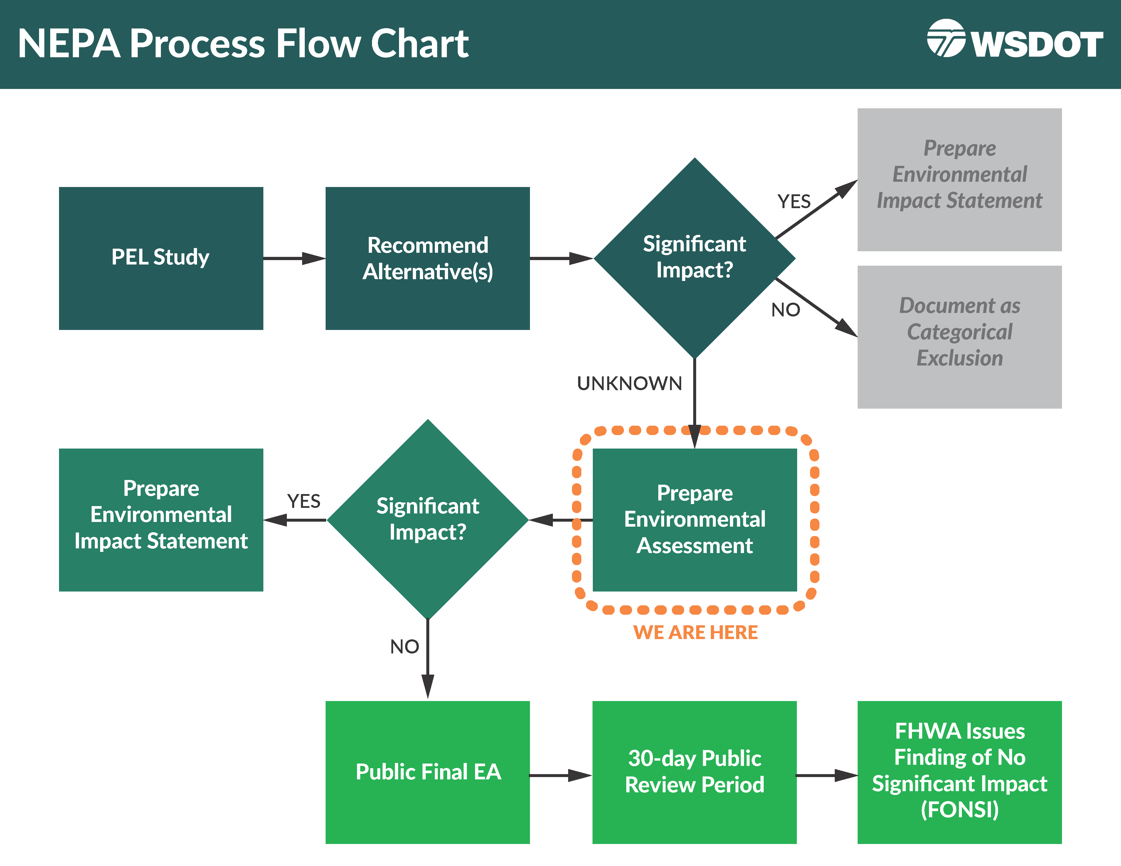
This project began with a federal Planning and Environmental Linkages (PEL) study focused on Interstate 5 from Marvin Road to Mounts Road. The PEL considered additional technical analyses and input from the community and partners to arrive at a final purpose and need. From there, recommended alternatives are being studied in the environmental review phase. WSDOT initiated the National Environmental Policy Act environmental review, studying I-5 from Marvin Road (Exit 111) to Mounts Road (Exit 116) in summer 2024. A draft NEPA report is scheduled to be available in fall 2025. The final environmental assessment is expected to be finished in 2026. For specific questions or comments about the NEPA process, contact our team. Visit the contact tab for team member contact information.
Funding is provided to accelerate work along I-5 through the Nisqually River Delta. The project has funding for preliminary engineering, design and right of way acquisition to address flood risk, improve mobility through the corridor between Mounts and Marvin Roads, and enhance the ecosystem at the I-5 Nisqually Delta crossing.
There is no construction planned at this time and traffic is not affected in this area.
What to expect
The National Environmental Policy Act environmental review process is underway. WSDOT is conducting the NEPA review as an Environmental Assessment. The purpose of an EA is to study and document the project's potential environmental impacts. The EA will study effects related to transportation, noise and natural resources. It will also examine parks and recreation, community resources and other environmental considerations.
WSDOT will study two scenarios in the EA: the proposed project (Build Alternative) and doing nothing (No Build Alternative).
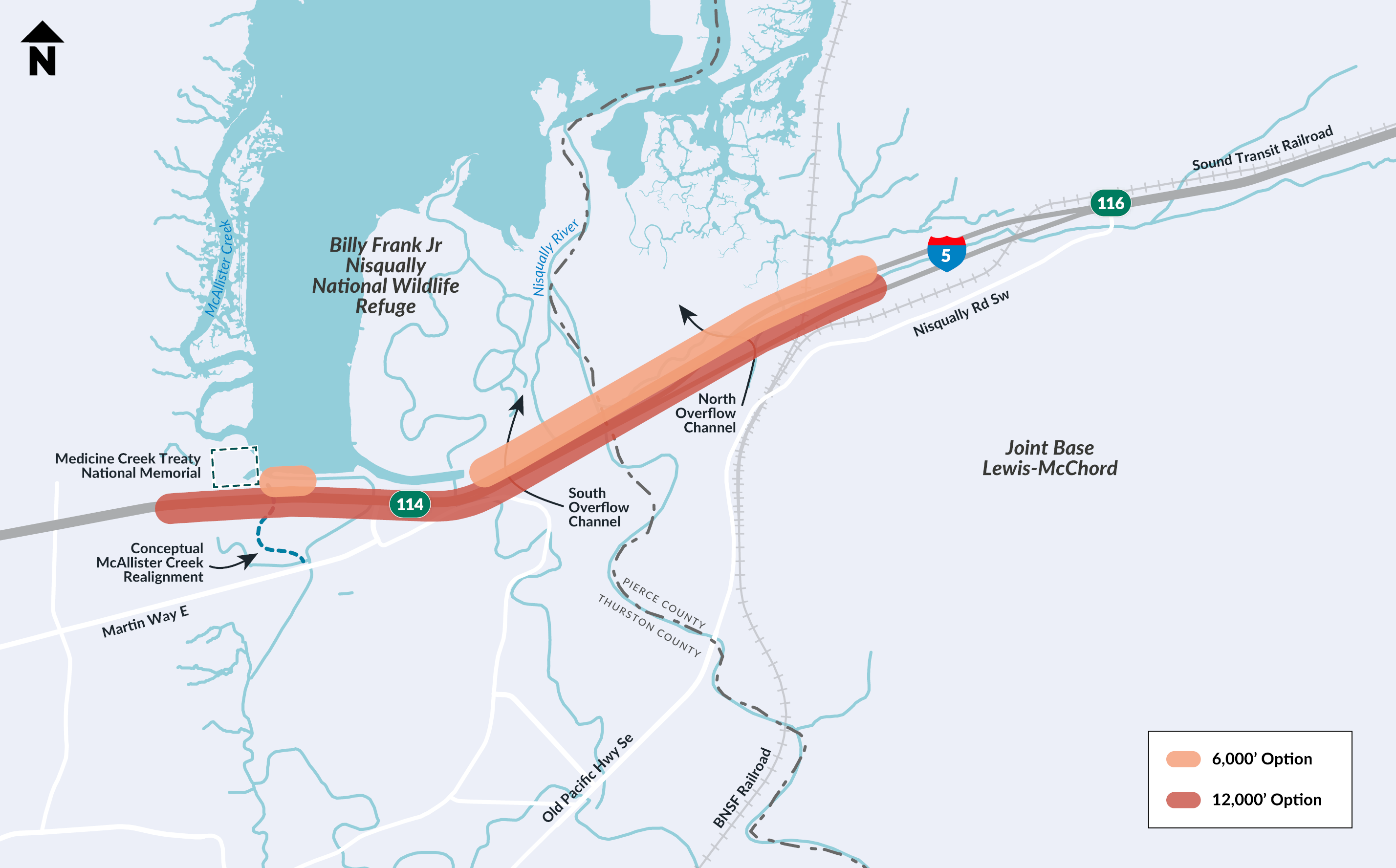
The EA will study a 4.7 mile stretch of I-5 between Marvin Road and Mounts Road interchanges. During the EA, WSDOT will:
- Evaluate potential design options for bridge length and other project elements.
- Identify potential environmental impacts of the project during construction and operation.
- Identify potential strategies to mitigate identified impacts.
The final PEL Report (PDF 4.8MB) was completed in 2023. You can find the report appendices under the History and Background tab. You can also find answers to the project's frequently asked questions (PDF 251KB).
The primary improvements proposed with the project include:
- Widen I-5 by adding one high-occupancy vehicle lane in each direction from approximately Marvin Road in Thurston County to Mounts Road in Pierce County.
- Replace existing bridges and construct new bridges across the Nisqually Delta to increase the resiliency of I-5 to flooding and sea level rise and to support habitat enhancements in the delta.
- Construct a new grade-separated crossing of the BNSF Railroad east of the Nisqually River.
- Realign McAllister Creek where it crosses I-5 to improve tidal exchange, water quality and fish habitat.
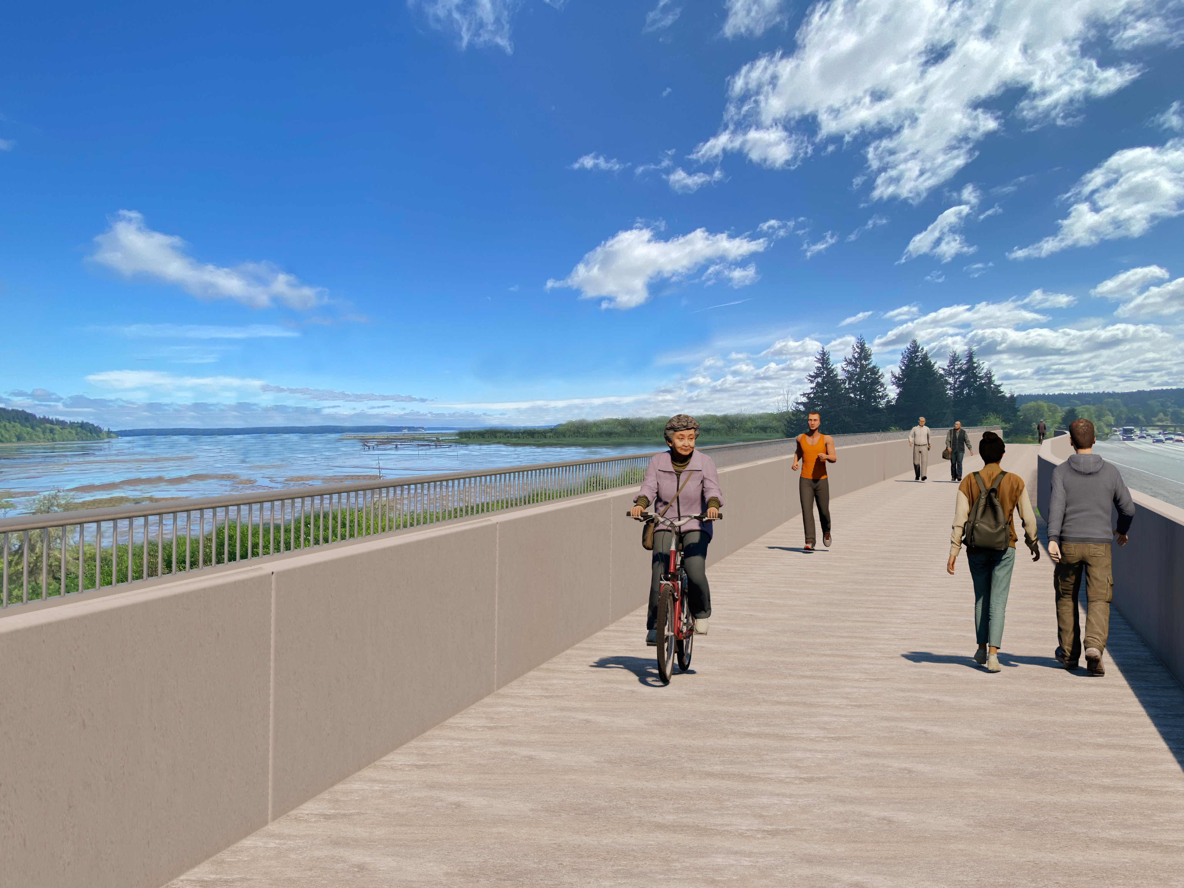
- Build a shared-use path adjacent to I-5, providing a nonmotorized connection between Lacey and DuPont, and improve access to the Billy Frank Jr. Nisqually National Wildlife Refuge.
- Remove two existing fish passage barriers under I-5 in the Red Salmon Creek drainage.
- Install new storm water treatment areas to treat runoff from I-5 within the project.
- Improve the surrounding habitat and allow for the creation of new habitat in areas where the existing I-5 embankment would be remove.

A National Environmental Policy Act review will look at I-5 from Marvin Road to Mounts Road and the area around the Nisqually River.