Planning study news
West Plains Subarea Transportation Management Plan Study, Phase 1, US 2 Vicinity
Timeline
Fall 2019 - Ongoing study
Status
In progress
Purpose
The US 2 West Plains Sub-area Management Plan Phase 1, refines previous studies that have been completed in the West Plains area. This "live" study addresses the mobility gaps (congestion) that have already been identified along this 8-mile, east-west corridor between the US 2/ I-90 interchange junction and Fairchild Air Force Base entrance. The study incorporates Practical Solutions Strategies, in collaboration with the Technical Advisory Team, to improve mobility in and around the US 2 corridor for all users. The study is ongoing and will be updated as new information is available.
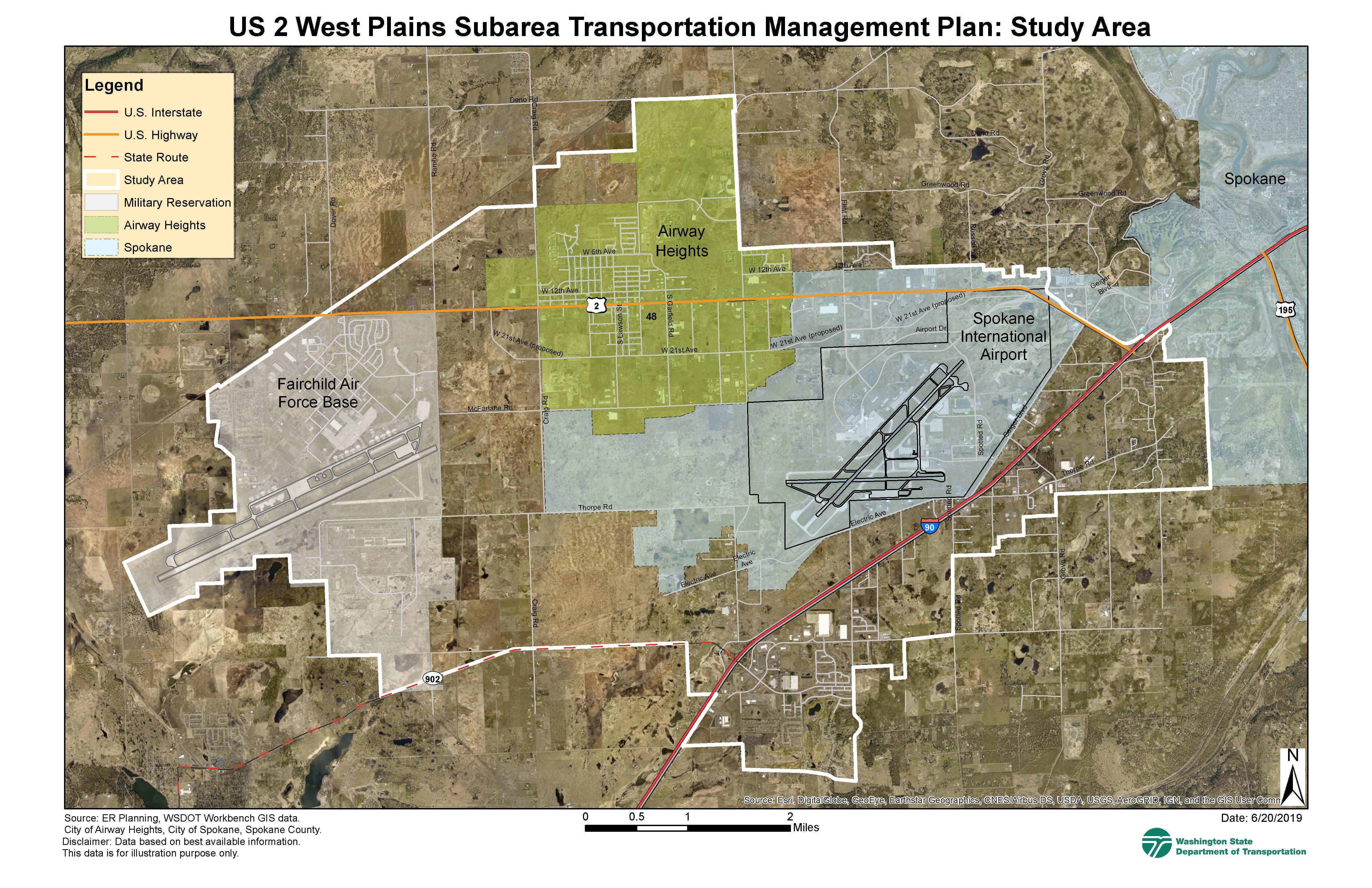
West Plains Subarea Transportation Management Plan Study, Phase 1, US 2 Vicinity, study area map. The oval-shaped study area extends from US 2/I-90 intersection and Dorset Rd. east to the Fairchild Air Force Base limits west; North from the city of Airway Heights limits, the railroad, and 12th St. to SR 902 and W Melville Rd., where it zigzags northeast all the way to 44th Ave. and Dorset Rd.