Planning study news
This study is complete. Thank you for your feedback
Timeline
Fall 2022 - Winter 2024
Status
Complete
Budget
$160,000
Purpose
The Town of Naches, the Yakima Valley Conference of Governments (YVCOG) and WSDOT are working together to provide a safe, reliable and effective transportation network for drivers, cyclists and pedestrians along the US 12 corridor in Naches, Washington.
The study area included the US 12 corridor between Allan Road and Jennings Lane and is approximately 1.6 miles long. It included the following intersections on US 12:
- Allan Road
- Kel-Lowry Road
- Shafer Avenue
- Naches Road / Avenue
- Jennings Lane
WSDOT works closely with project partners, stakeholders, and community members to gather feedback to understand issues in the study area, as well as developed a list of solutions and strategies that will be effective and sustainable if implemented.
Planning study report
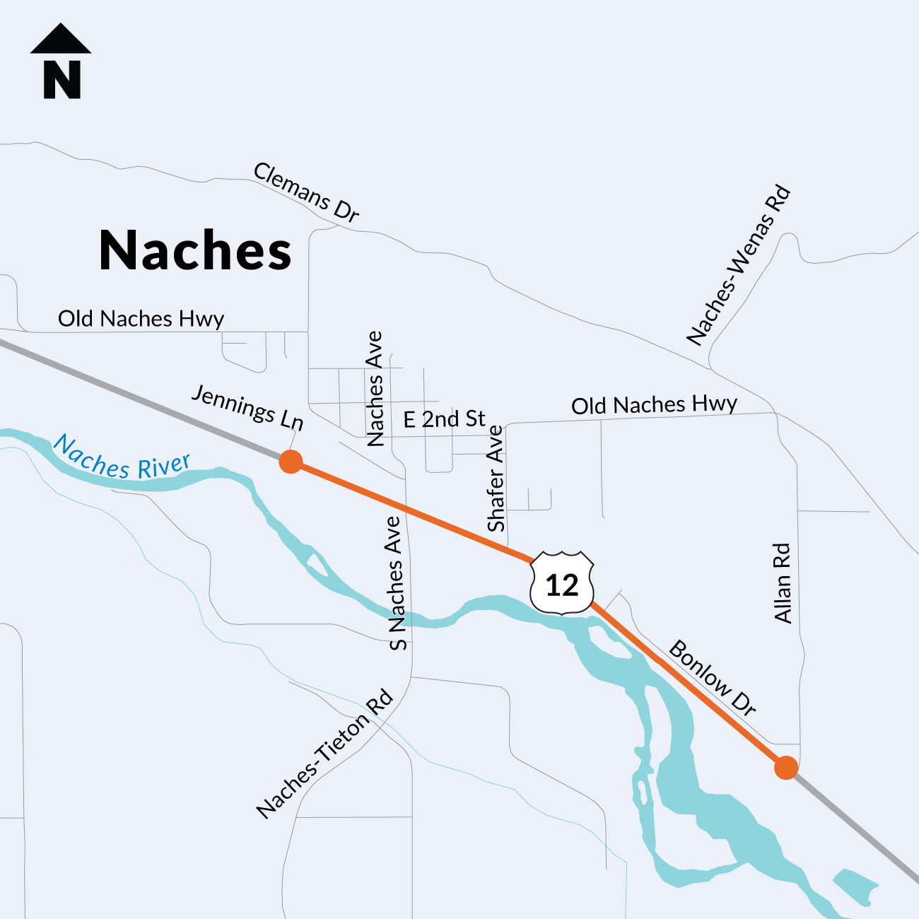
The study area for the US 12 Naches Active Transportation Corridor Study included US 12 within the town of Naches, Washington, between Allan Road and Jennings Lane. It is approximately 1.6 miles long.