Project overview
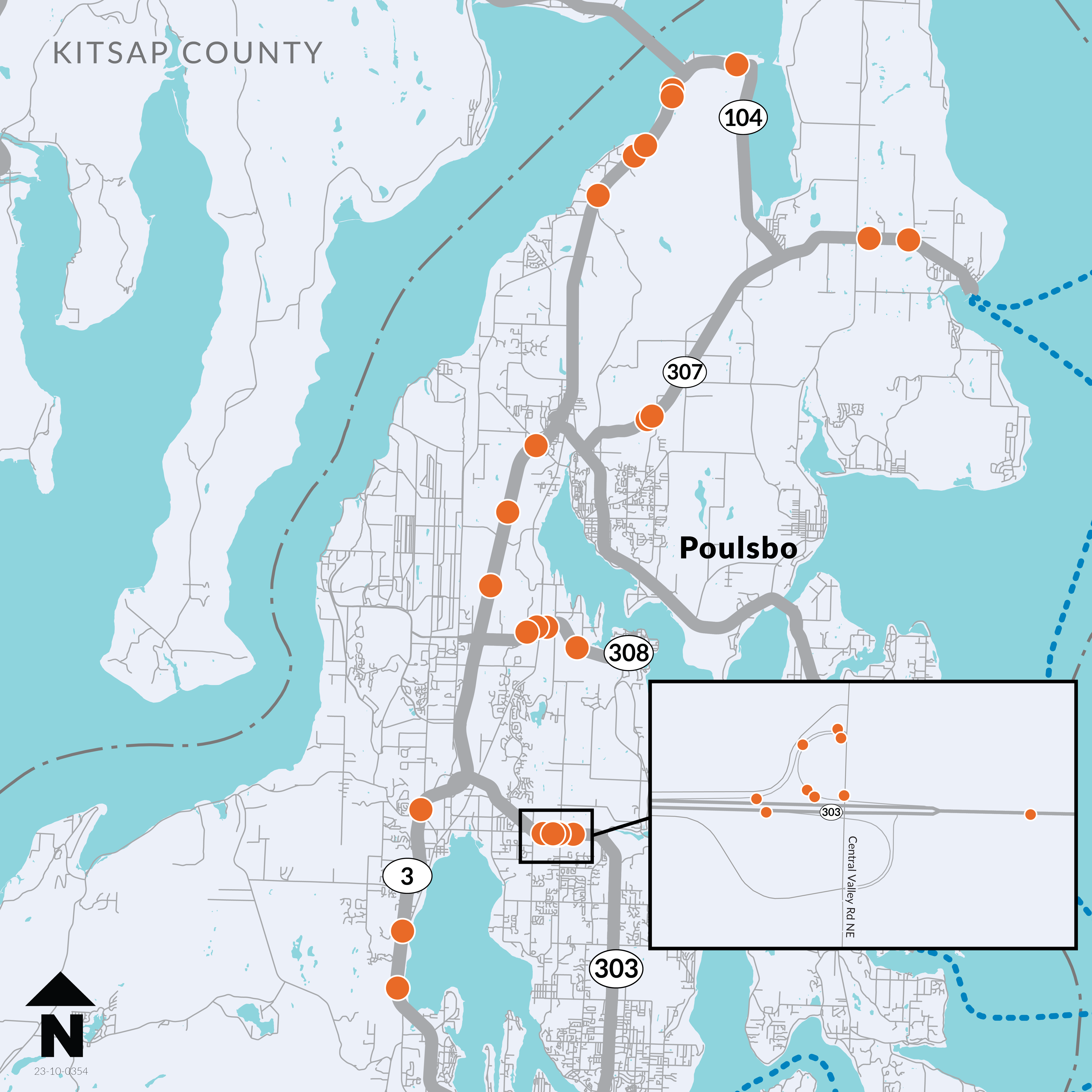
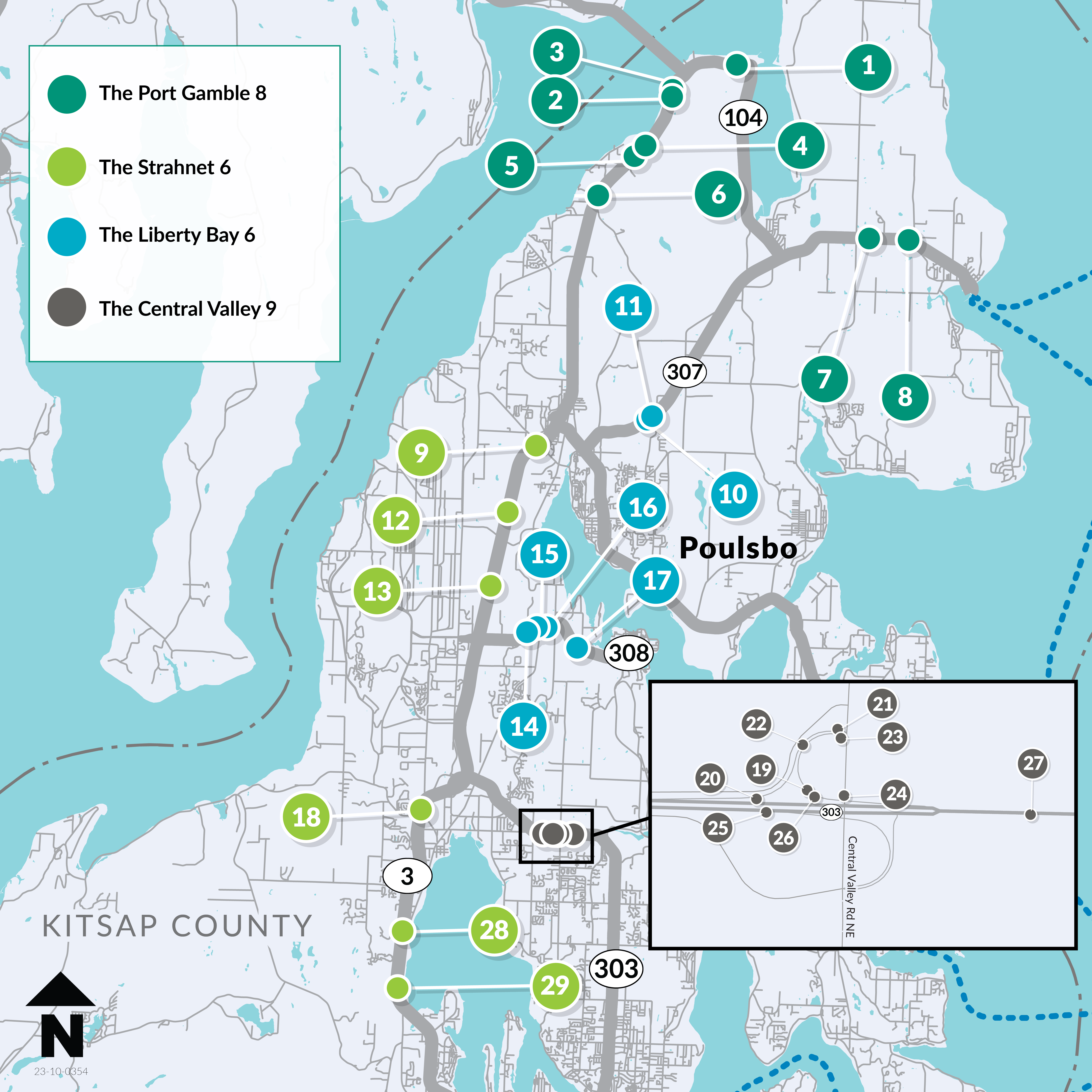
This project will remove barriers to fish under several state highways in Kitsap County. Work is planned in 29 locations on state routes 3, 104, 303, 307 and 308.
Once complete, this project will restore approximately 93 miles of potential habitat across the Kitsap Peninsula.
What to expect
Fish barrier removal sites along state highways in Kitsap County are grouped by general location. As this project is still in design, timelines may shift before going to construction.
Travelers may notice preliminary work and occasional one-way alternating traffic at the locations listed below. Real-time information is available via the Travel Center Map.
Liberty Bay, 6 sites, 2027-2029
- Poulsbo and Liberty Bay area, Bond Road/SR 307 and SR 308
- Online and in-person open houses were held in June 2025
Central Valley, 9 sites, 2028-2030
- Silverdale and North Bremerton area, SR 303
- Online and in-person open houses were held in November 2025
- An outreach summary can be found under the 'History and background' section below
Port Gamble, 8 sites, 2028-2030
- Hood Canal, Port Gamble and Kingston areas, SR 3 and SR 104
Strahnet, 6 sites, 2028-2029 - Poulsbo and Silverdale areas, SR 3
A map of central and north Kitsap Peninsula's state highways. Orange dots show the locations of 29 fish barrier removal projects. The sites are divided into four separate groups that will go to construction at different times between 2027 and 2030.
Waaga Way (SR 303)/Central Valley Road Outreach Summary
Introduction
State highways cross over rivers and streams in thousands of locations throughout Washington. Some crossings can impede fish migration. Since 1991, the Washington State Department of Transportation has worked to improve fish passage and foster healthy waterways by removing or restoring barriers that can limit or prevent fish and other aquatic species from moving freely to feed, migrate, and reproduce.
Since 2013, WSDOT has worked to comply with the requirements of a U.S. District Court injunction to correct barriers to salmon and steelhead within the case area. As of June 1, 2025, WSDOT has corrected 176 injunction barrier culverts and improved access to 654.61 miles* (1053.49 kilometers) of potential habitat for salmon and steelhead. Statewide, WSDOT has completed 457 fish passage barrier corrections to date.
The Kitsap 29: SR 3 / SR 104 / SR 303 / SR 307 / SR 308 Kitsap County – Remove Fish Barriers project corrects 29 identified streams and culverts that cross under state highways in Kitsap County. The overall project is divided into four bundles:
- The Port Gamble 8
- The Liberty Bay 6
- The Strahnet 6
- The Central Valley 9
WSDOT is using the progressive design build approach to correct the four bundles in Kitsap 29. Estimated timeline for design and construction is from 2026 to 2031.
Agency Coordination
Since 2022, WSDOT has been coordinating with several key groups for the SR 3, SR 104, SR 303 and SR 307, Kitsap County Remove Fish Barriers project, including:
- Kitsap County
- National Marine Fisheries Service
- Port Gamble S’Klallam Tribe
- Skokomish Tribe
- Suquamish Tribe
- United States Fish and Wildlife Service
- United States Navy
- Washington State Department of Archaeology and Historic Preservation
- Washington State Department of Ecology
- Washington State Department of Fish and Wildlife
These partners provided information about their ongoing projects or provided technical guidance or technical reviews for this project. WSDOT will continue to engage these partners and additional resource agencies to ensure alignment with regulatory requirements and priorities.
Community Engagement
WSDOT prioritizes meeting people where they are — by going directly into the communities it serves. This approach guided the decision to host an in-person open house and build an online open house.
WSDOT also maintains a project website found at:
In-Person and Online Open House
WSDOT promoted the in-person open house and online open house using social media, a news release and mailers to the local community. The online open house was available Oct. 30 to Dec. 12 while the in-person open house was held on Nov. 13. The open house content was the same for both in-person and online. The online open house content was translated to Spanish to meet English Language Proficiency.
Social media: WSDOT Facebook account
The Facebook post received 36,764 views, 40% non-followers; 145 interactions (comments/reactions/clicks); 37 link clicks.
Mailers: WSDOT sent mailers in English and Spanish to 12,302 addresses in and around the project area.
News release: WSDOT issued a news release on Oct. 30, 2025, advertising the in-person and online open house.
- 2,729 recipients in Kitsap County received the release via GovDelivery. They include media, first responders, community partners and people who subscribe to WSDOT traffic and construction news lists on GovDelivery.
Project flier: At the in-person open house, WSDOT provided a project flier in English and Spanish.
Spanish translator: WSDOT provided a Spanish translator at the in-person open house.
Outreach results
- The online open house, hosted on the WSDOT Engage website, saw a total of 4,600 page visits and 276 comments.
- The mailer and print flier included a QR code that directed people to the online open house. The code was scanned 243 times.
- The in-person open house, held at Fairview Middle School in Bremerton, WA on November 13, 2025, drew at least 172 attendees and 61 in-person comment forms. At the event, 112 attendees opted in to a project email list.
- Holding an in-person open house made it easier for residents to engage in a familiar, local setting, and helped ensure community voices were heard.
Kitsap County staff were also present to answer questions and engage with attendees through genuine, face-to-face conversations.
Public Comment
The in-person and online open houses offered opportunities for public input, enabling community members to share questions and feedback. Participants had the option to provide contact information if they wished to receive responses to their questions, and they could also sign up for the project email list to receive ongoing updates. The comment forms were open-ended to encourage detailed input, and no demographic information was collected.
Community Feedback
WSDOT received 61 in person comment forms and 276 online comments.
The most common questions were:
- What is the purpose of this project?
- Why are these sites classified as fish barriers?
- Is this project related to the housing development?
- Why is a roundabout being built?
- How much will this project cost?
- Who is paying for this project?
- What were the other alternatives?
- What evidence of fish is there?
- How does the project intend to incorporate pedestrians and bicyclists?
Responses to the common questions are found at the end of this document.
Additional comments and questions regarding the following topics were received from the public during the open house events:
- Accuracy and validity in the identification of fish barriers
- Lack of alternatives presented to the public
- Paulson Road as the proposed detour route, including concern regarding shoulder width, pedestrian and bike access, speeding, traffic backups, and detour duration
- Roundabout placement and configuration
- Removal of the westbound SR 303 ramps to and from Central Valley Road
- Traffic congestion on SR 303 due to the addition of a roundabout
- Traffic congestion on the eastbound SR 303 off-ramp and Central Valley and Bucklin Hill signal due to the removal of the westbound off-ramp
- Construction of the nearby housing development
- Concern regarding the high cost of the project
- Concern WSDOT is not spending enough money to avoid a roundabout
- Concern that an acceleration lane should be added for eastbound SR 303 traffic from Central Valley Road
As a result of the feedback, WSDOT began exploring additional design and construction options including the feasibility of adding an additional right-turn only lane on the SR 303 exit to Central Valley Road and investigating several other potential detour route options to be used for this project.
Other design considerations received from the public have been incorporated by WSDOT into the project’s list of design considerations, including:
- Beaver activity near the project sites
- Speeding concerns along Brownsville Highway, a segment of the proposed detour route
- Recurring roadway icing concerns north of the Central Valley Road overpass
- Accommodation of live animal transport to and from the fairgrounds in the roundabout design
- Limited sight distance at the intersection of Brownsville Highway and Paulson Road along the detour route
- Standing water and flooding issues on SR 303 near the Central Valley Overpass
- Signal timing concerns at the intersection of Central Valley Road and Bucklin Hill Road
- Community avoidance of the Central Valley Road on-ramp to eastbound SR 303, potentially indicating inaccuracies in traffic data
Conclusion
The engagement process yielded a robust community response and provided feedback to WSDOT for consideration. Community feedback highlighted several key themes:
- Concern regarding accuracy and validity in the identification of fish barriers
- Frustration over the lack of alternatives presented to the public
- Concern regarding the proposed Paulson Road detour route
- Traffic impacts due to roundabout placement and removal of westbound SR 303 ramps to and from Central Valley Road
Responses to common questions
Project purpose
This project will remove nine blocking culverts under Waaga Way and is part of a broader effort to correct 29 barriers to fish under state highways across Kitsap County. Since 2013, WSDOT has worked to comply with the requirements of a U.S. District Court injunction to correct barriers to salmon and steelhead within the case area. The project will remove fish barriers in compliance with state laws and a federal court injunction.
Sites classified as fish barriers
The Washington State Department of Fish and Wildlife identified that this project location has the presence or potential presence of Chum, Chinook, Coho, Steelhead, Sea-run Cutthroat, and Resident Trout. The WSDOT Fish Passage Map shows the locations of all sites the Washington State Department of Fish and Wildlife (WDFW) has identified as a fish barrier. This project will remove nine blocking culverts under Waaga Way and is part of a broader effort to correct 29 barriers to fish under state highways across Kitsap County.
Area housing development
No, this project is not related to housing development. This project removes fish barriers to meet state and federal requirements.
Reason for roundabout location
A roundabout at this location presents several important benefits for the community and local environment. The primary goal of this project is to remove barriers to fish passage. By implementing this alternative, the project is able to create and support fish and aquatic habitat. This solution is the most cost-effective option available. It eliminates the need to construct and maintain expensive structures, thereby reducing long-term financial commitments associated with other alternatives.
The interchange serves as a dividing point between a more urban area to the west and a more rural area to the east. The rural area to the east is undergoing rapid development and has more access points from surface streets and driveways. The roundabout encourages drivers to slow down while creating minimal delay.
Project cost
This project will remove nine blocking culverts under Waaga Way and is part of a broader effort to correct 29 barriers to fish under state highways across Kitsap County. For all 29 barrier corrections, the SR 3 / SR 104 / SR 303 / SR 307 / SR 308 Kitsap County Remove Fish Barriers Project is valued at approximately $665-$715 million. As this project is still in the design phase, the actual cost is not yet determined.
Funding source
Funding for the project is included in the state transportation budget which is approved by the Washington State Legislature and signed by the Governor. More information about fish passage funding is found on the WSDOT Fish Passage Funding website.
Design alternatives
Several alternatives were evaluated for this project, including:
- a partial diamond configuration with westbound off-ramp only,
- a full diamond interchange with both westbound on- and off-ramps,
- rebuilding the existing ramps with new culverts or bridges,
- a full removal of the westbound on- and off-ramps paired with a roundabout.
Each option was reviewed against a range of criteria, including environmental impacts, right-of-way needs, geotechnical and structural considerations, keeping people moving during construction, stream and drainage conditions, long-term maintenance, cost, safety, and constructability. Long-term traffic operations were also considered.
Ultimately, the option to remove the on- and off-ramps emerged as the preferred alternative. It provides the greatest benefit to fish and aquatic habitat, an essential objective of the project, while also being the most cost-effective solution. This alternative eliminates the need to construct and maintain expensive structures. This approach prevents the need to tear out and later rebuild the on- and off-ramp north of NE Waaga Way.
Additionally, the interchange serves as a transition between a more urban area to the west and a more rural area to the east. The rural area to the east is undergoing rapid development and has more access points from surface streets and driveways. The roundabout encourages drivers to slow down while creating minimal delay.
Traffic modeling shows the roundabout can manage projected volumes with minimal delay.
Injunction barrier identification
As part of the federal injunction, proof of fish is not required for the Washington State Department of Fish and Wildlife to add a site to their fish barrier inventory. Instead, WDFW identifies barriers using its Fish Passage Manual, which instructs them to identify streams that meet basic physical criteria or have other evidence of fish use (mapped as fish-bearing, observed salmonids, or reliable biological data).
Pedestrians and cyclists
This project does not significantly change Central Valley Road and traffic will continue to cross over SR 303 at this location after construction. SR 303 is currently a freeway with both Full Access Control and Modified Access Control, meaning pedestrians are not permitted at the existing interchange ramps and to the west. Consistent with the current freeway designation, no pedestrian facilities are being added with the proposed roundabout. Bicycle access, however, is being incorporated into the project. Westbound cyclists will maintain the same level of access they have today via the existing pathway. Eastbound cyclists will continue to have access to SR 303 and WSDOT is currently evaluating the eastbound bicycle route to ensure that cyclists using the existing shoulders can safely navigate the new roundabout.