Wildlife habitat connectivity - I-5 Linkage Zones
Performance analysis
2023
Interstate 5 Northern and Southern Linkage Zones identified as crucial ecosystem connections
Two sections of Interstate 5 between Olympia and Vancouver bisect critical wildlife corridors linking the Cascade Mountains to the Willapa Hills and the Olympic Peninsula. These sections are known as the Northern Linkage Zone, which stretches between Tumwater and Grand Mound, and the Southern Linkage Zone, which lies between the Cowlitz River Bridge and Castle Rock. These two Linkage Zones are each approximately nine miles long and are the only locations along I-5 that could provide viable connections between ecosystems isolated by transportation features. The opportunities to bridge these barriers along I-5 are quickly dwindling due to rapid development of adjacent areas.
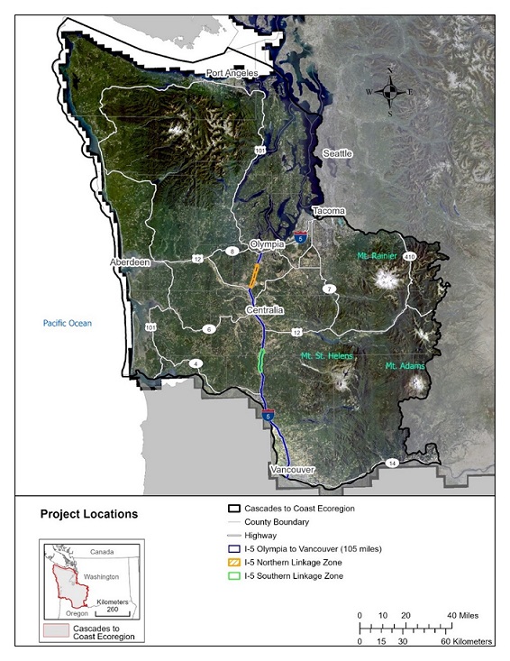
These Linkage Zones record between 41,000 to 68,000 vehicles per day across six lanes of traffic, well above the threshold of 10,000 vehicles per day that is considered a complete barrier to wildlife passage. Recent research indicates cougars west of I-5 are genetically isolated from populations east of it due to traffic creating barriers limiting animal movement between habitats on either side. This area has been identified as a corridor for cougar, elk, black-tailed deer, and other species. However, safe crossing opportunities are currently inadequate to support the diversity of species in these zones.
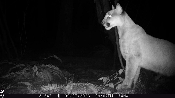
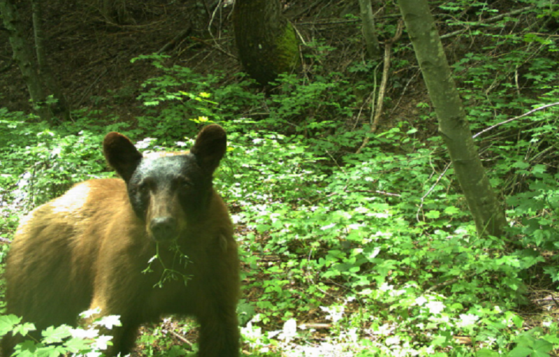
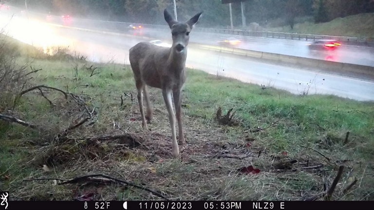
In addition to negative impacts imposed on wildlife populations by the barrier effect, the Southern Linkage Zone is a statistically significant wildlife-vehicle collision hotspot primarily involving black-tailed deer. A diversity of species are involved in wildlife-vehicle collisions in the Northern Linkage Zone, such as black bear, bobcat, elk and black-tailed deer.
Consultants are completing a feasibility study with federal, state, and tribal government agencies, non-profit organizations, universities, and individuals to determine connectivity solutions across I-5 in these areas. This feasibility study will use biological data as well as engineering opportunities and limitations to identify the best locations for wildlife crossings. The study will produce conceptual designs for wildlife crossings at site-specific locations, as well as cost estimates. This information will help identify and secure appropriate funding to achieve long-term goals of building wildlife crossings in the Northern and Southern Linkage Zones.
Biological data in consideration for the feasibility study includes a large wildlife camera monitoring effort being conducted by WSDOT. Central Washington University is collecting data about amphibians and reptiles in the areas, which will supplement wildlife camera data by providing information on smaller species that are not detected by cameras.
Community engagement leads to learning and potential career development opportunities
Among the collaborators for the Northern and Southern Linkage Zones feasibility study, middle school students from the Natural Resources class at the Toutle Lake School conducted projects centered around connectivity across I-5. These students installed wildlife cameras for the feasibility study and analyzed the images their cameras captured. In their final presentations, students created charts and graphs to visualize their data, and included an artistic rendering of a wildlife crossing. This ongoing career development opportunity allows students to get out of the classroom and learn about potential careers in natural resources.
2022
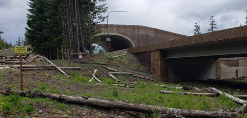
Snoqualmie Pass East Project improves wildlife habitat connectivity
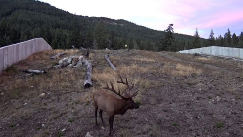
At the end of 2022, WSDOT recorded the 20,000th safe wildlife crossing by camera at completed structures within the ongoing Snoqualmie Pass East Project, where WSDOT and partners have built 11 large wildlife crossing structures so far. These crossings included 5,959 elk, 12,068 deer, 2,016 coyote and several crossings by rare species like moose, cougar, American marten, fisher, and American pika.
The Snoqualmie Pass East project is located along a 15-mile stretch of I-90 between Hyak and Easton. This corridor passes through the Okanogan-Wenatchee National Forest and is a critical connectivity zone for Pacific Northwest wildlife populations. Ecological connectivity components of the project include more than 20 large wildlife crossing structures, including two major overpasses, and continuous wildlife fencing throughout most of the project area. In addition to improving ecological connectivity across I-90, the project aims to fulfill multiple objectives, including reducing avalanche and rock fall impacts, replacing failing concrete pavement, and adding lanes to reduce congestion.
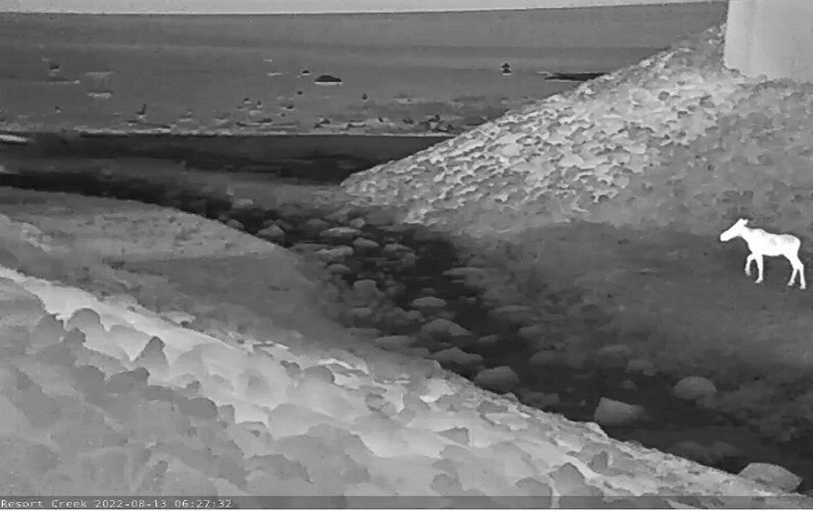
In August 2022, a moose was documented using a wildlife underpass within the Snoqualmie Pass East Project area to cross I-90, heading south. This moose was approximately 100 miles from its known core range. A couple weeks later, the first moose ever documented in western Washington was recorded in the Cedar River Watershed, and another couple months later, Mount Rainier National Park recorded its first ever moose visitor. While it can't be known with absolute certainty whether it was the same moose it is extremely likely. Wildlife underpass structures allow thousands of safe wildlife crossings annually and give animals opportunities to naturally expand their range into suitable habitats previously unreachable due to transportation infrastructure. Meanwhile, wildlife-vehicle collisions within the completed areas of the Snoqualmie Pass East Project dropped to a consistently low or non-existent level.
Monitoring teams from Central Washington University documented many small mammals, amphibians and fish utilizing the crossing structures, including western toads breeding in a wetland south of the overcrossing two years in a row, culminating in newly-metamorphosed western toadlets safely crossing I-90 using the same overcrossing. Furthermore, coastal giant salamanders and American pika were documented crossing I-90 at multiple structures, and federally-threatened bull trout were documented using holding pools beneath the Gold Creek Bridge.
The project's final two phases (Phases 3 and 4) will address the remaining portions of the corridor by installing seven additional large wildlife crossing structures, including a second overcrossing, and many small and medium-sized bridges and culverts for water and low-mobility species passage.
2021
Snoqualmie Pass East Project improves wildlife habitat connectivity
The Snoqualmie Pass East (SPE) Project is located along a 15-mile stretch of I-90 between Hyak and Easton. This corridor passes through the Okanogan-Wenatchee National Forest and is a critical connectivity zone for Pacific Northwest wildlife populations. The project aims to fulfill multiple objectives, includingreducing avalanche and rock fall impacts, replacing failing concrete pavement, adding lanes to reduce congestion, and improving ecological connectivity across I-90. The project will enhance ecological connectivity for multiple wildlife species at 14 connectivity emphasis areas. Ecological connectivity components include more than 20 large wildlife crossing structures, including two major overpasses, and continuous wildlife fencing installed throughout most of the project area.
Within the completed portions of the Snoqualmie Pass East Project, WSDOT and partners built 11 large wildlife crossing structures.
WSDOT recorded a minimum of 8,683 wildlife crossings by camera in 2020 and 2021. These included 3,202 elk crossings, 4,382 deer crossings, 764 coyote crossings and several low-density and rare species like cougar, American marten, fisher, and American pika taking advantage of the structures to safely cross I-90.
Monitoring teams from Central Washington University additionally documented many small mammals, amphibians and fish utilizing the crossing structures, including a radiotracked western toad that crossed using the overpass.
The final phases of the project will address the remaining portions of the corridor by installing seven more large wildlife crossing structures and many smaller culverts and bridges for water and low-mobility species passage.
