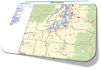
The WSDOT GeoPortal is an application that allows users to view WSDOT spatial data (like Functional Class, Interchange Drawings, City Limits and State Routes) via a web browser. Users can check a box to select from a variety of base maps and data layers. They can click on the map to return a State Route Mile Post value or type an address to zoom to.
 For first time users: There is a Help and Users Guide that will assist you in getting started with the application. You can also access this guide from the application’s Help tool.
With the GeoPortal, you can:
Application Updated - 7/8/2015
Find Route Location - now has the ability to 'locate a line' (previously 'Find Milepost').
Find Nearest Route Location - now shows 'offset' information (previously 'Find Nearest Milepost).
The Pop Up window - now has 'Google' and 'Street View' options available
Buffer Tool - lets you select a feature and create a buffer using meters, miles or feet
Draw Tool - lets you add text element to your map
Toggle Option - allows you toggle between different GeoPortal configurations from a drop down box within the application.
Feedback and data questions, please send to: Online Map Support