How do you want to travel?

View data by road
See real-time alerts, cameras and restrictions in a list view by road.
Which road?
View alerts and cameras by route
View boarding status by terminal
Which airport?
Projects and improvements in your county.
Explore the progress of projects focused on creating safe and reliable ways to move people and goods around Washington.
County
Featured Project
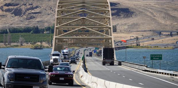
I-90 Vantage Bridge – Replace Bridge Deck and Special Repairs
Travelers crossing the Columbia River on I-90 will see lane closures over spring and summer as crews work to replace the entire surface of Vantage Bridge.
Access the resources you need to maintain and improve the transportation system.
Latest from WSDOT...
- WENATCHEE – Repairs will help extend the life of roadways in Oroville, Royal and Vantage
- VANCOUVER – Travelers who use Interstate 5, I-205, State Route 14 and SR 500 will soon have smoother ramps when entering or leaving the highways.
- TONASKET – A trio of roads in Okanogan County will be repaved this spring, to extend their service life.