SR 520 - Natural Resource and Parks Mitigation
 Aquatic mitigation site
 Park resources
 Wetland mitigation site
 Wetland and aquatic mitigation site
Click the colored icons in the map to find more information on specific SR 520 mitigation projects.
How is WSDOT mitigating for construction impacts of the SR 520 Bridge Replacement and HOV Program?
When planning transportation projects, WSDOT first seeks to avoid or minimize adverse effects to the environment. If a project has unavoidable effects, we must mitigate for them. On the SR 520 Bridge Replacement and HOV Program, we have conducted mitigation projects at numerous sites, primarily in the Lake Washington watershed, to compensate for the program’s impacts. While the majority of our mitigation projects are now complete, a few remain, such as mitigation at the WSDOT Peninsula in Montlake, which will be completed near the end of the SR 520 Program. As SR 520 construction moves forward, WSDOT has made various design refinements that reduce our anticipated impacts on the natural environment. Consequently, we continue coordinating with regional stakeholders to ensure that our environmental mitigation program matches up with our construction impacts. You can find more information about our environmental projects by clicking on the individual sites shown on the map above.
How did WSDOT identify its mitigation projects and locations?
To identify mitigation sites, WSDOT undertook a comprehensive, watershed-based screening process in coordination with local, state and federal regulatory agencies, tribes and other stakeholders. WSDOT restores construction-related impacts that occur on site. We have also conducted as much mitigation work as possible within the boundaries of project construction. On-site mitigation is limited, however, by existing land use, high-density development within the SR 520 corridor, and insufficient mitigation locations in the corridor. So, to meet our environmental commitments, WSDOT also conducted substantial environmental mitigation at off-site locations.
In most cases, specific mitigation projects have been implemented by WSDOT and our mitigation partners. In other instances, WSDOT contributed to King County’s Mitigation Reserves Program in lieu of conducting or sponsoring a site-specific project. This in-lieu option provides fund contributors like WSDOT the ability to pool resources and fund mitigation projects that can yield greater environmental benefits and might otherwise have insufficient funding. Participating in an in-lieu fee program is the preferred approach by our state and federal regulatory agencies. Additional information on the natural resources mitigation planning process and proposed wetland and aquatic mitigation sites can be found in the wetland mitigation plan (pdf 18.7 mb) and Aquatic Mitigation Plan (pdf 5.6 mb).
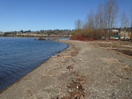
Timeline: The state Department of Natural Resources (DNR) designed the site, began construction in summer 2014, and completed the work in 2015.
Type of mitigation: Aquatic
Total acreage: 4 acres
Description: WSDOT funded aquatic mitigation at the south end of Lake Washington in the city of Renton at property owned by the DNR. Mitigation work included restoring shoreline vegetation, enhancing shoreline substrate, and removing old structures to improve conditions for young salmon migrating from the Cedar River to Lake Washington and Puget Sound.
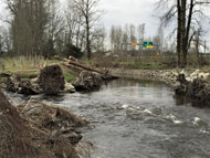
Timeline: The city of Redmond began construction in summer 2013 and completed the work in 2015.
Type of mitigation: Aquatic
Total acreage: 15.4 acres
Description: WSDOT provided funding to implement aquatic mitigation at the Bear Creek site in Redmond. Stabilizing the bank, adding stream gravel and wood, and planting along the creek help address habitat diversity needs identified in the Water Resource Inventory Area (WRIA) 8 Chinook Salmon Recovery Plan.
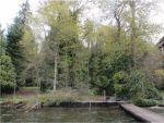
Timeline: The site is being rehabilitated as part of the SR 520 Floating Bridge and Landings Project and is expected to be complete in 2017.
Type of mitigation: Aquatic
Total acreage: 0.9 acre
Description: WSDOT is performing aquatic mitigation beneath the East Approach of the new SR 520 floating bridge. Activities include supplementing lakebed gravel along the shoreline, removing an existing bulkhead and rubble, and restoring Lake Washington shoreline and vegetation. This in-corridor mitigation is intended to provide aquatic benefits such as beach spawning habitat for sockeye salmon and improved near-shore habitat for juvenile Chinook salmon.
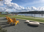
Timeline: The city of Seattle started construction in spring 2018 and completed the new park in early fall 2020.
Type of mitigation: Parks
Total acreage: 3.5 acres
Description: WSDOT supported the city of Seattle’s creation of the new public park along Portage Bay at the site of a former UW police station and Bryant’s Marina. The park provides enhanced views, a connection to the waterfront for bicyclists and pedestrians on nearby streets and the Burke-Gilman Trail, water access for hand-carried boats, and a casual open space for other users.
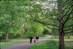
Timeline: Park improvements started in 2012; completion date yet to be determined.
Type of mitigation: Parks
Description: WSDOT funded a variety of improvements in the Arboretum, including: traffic-calming measures; an improved multiuse trail that provides an important bicycle and pedestrian connection from East Madison Street to the Montlake and University of Washington; enhancements to Arboretum Creek and Foster Island; shoreline restoration; a new North Entry to the Arboretum; and a new roundabout at Foster Island Road and Lake Washington Boulevard.
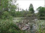
Timeline: WSDOT began construction in early 2016, and expects to complete construction in 2017.
Type of mitigation: Wetland
Total acreage: 22.7 acres
Description: WSDOT is supporting the University of Washington’s Union Bay Natural Area Management Plan by establishing new wetlands, enhancing existing wetlands and buffers, removing invasive and non-native species, and replanting with native species.
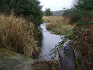
Timeline: WSDOT crews completed construction in 2013 and will monitor the site until 2024.
Type of mitigation: Wetland
Total acreage: Approximately 30.8 acres
Description: WSDOT provided wetland mitigation at the confluence of Bear Creek and Evans Creek near the city of Redmond. The mitigation work on land that previously was farmed strengthens the local natural environment by improving the quality of wetland habitat.
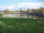
Timeline: Mitigation work is planned to occur once SR 520 construction is complete and WSDOT no longer needs this area for construction staging.
Type of mitigation: Wetland
Total acreage: 5.9 acres
Description: WSDOT plans to provide wetland mitigation within this WSDOT-owned property next to the Washington Park Arboretum. The work will include removing debris, controlling invasive plant species, adding habitat features, and enhancing wetlands and wetland buffers with native species. WSDOT plans to convey the property to the city of Seattle after completing SR 520 reconstruction.
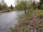
Timeline: King County completed final design and began construction in 2015. The work is scheduled for completion in 2017.
Type of mitigation: Wetland, aquatic
Total wetland mitigation acreage: 2.3 acres
Total aquatic mitigation acreage: 4.8 acres
Description: WSDOT provided an in-lieu fee credit at this site through the King County Mitigation Reserves Program. This mitigation project, which restores floodplain and wetland functions, adds habitat in the Cedar River basin for salmon spawning and rearing, addressing needs identified in the WRIA 8 Chinook Salmon Conservation Plan.
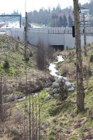
Timeline: WSDOT crews completed this project in 2014.
Type of mitigation: Wetland, stream
Total mitigation acreage: 3.2 acres
Description: Wetland and stream restoration along the Eastside’s Yarrow Creek included removing fill to create and enhance wetlands, relocating and lengthening a section of Yarrow Creek, planting with native species, and creating habitat diversity. The Eastside Transit and HOV Project also constructed eight large "fish culverts" along the corridor – six running beneath the highway – to improve fish migration.
 Aquatic mitigation site
 Park resources
 Wetland mitigation site
 Wetland and aquatic mitigation site